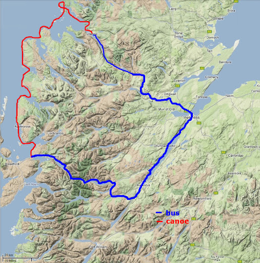
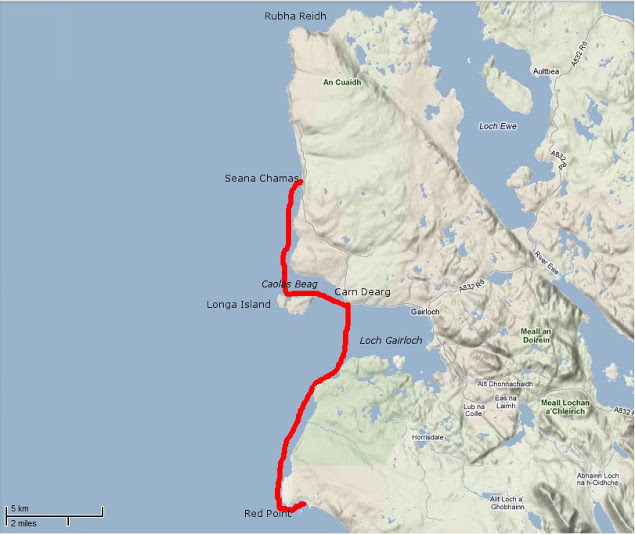
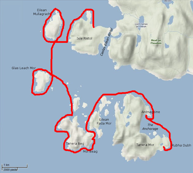
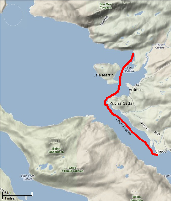
In 2011 I met Gael after he ran out of time and weather to complete the second stage of the Scottish Sea Kayak Trail he started in 2010 in his Grabner H2. According to the guy who wrote the guidebook, the SSKT is a 500-km run through the Inner Hebrides from the Isle of Gigha off the Kintyre peninsula to the Summer Isles, but with no shoreside infrastructure as such, most just follow their nose with the book’s help.
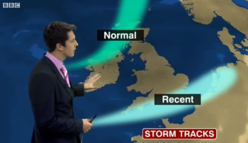
In 2012 Gael returned to Skye for another go, now in the ex-demo Incept K40 be picked up from Sea Kayak Oban. In March that year Scotland experienced some very fine weather while England got the converse – a result of a misplaced jet stream (right). And so it was for Gael who managed a comparatively trouble-free run all the way to Ullapool where he rolled up his boat and bussed back to his car on Skye.
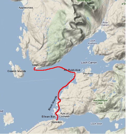
Day 1 – Kyleakin to Uags
The trip began rather badly. I arrived around midnight in Kyleakin after an interminable drive from Paris with an exhausting final crossing through the Highlands mostly in the rain. I set up my tent quickly on the grass by the hostel’s backyard. Once in my sleeping bag, I fell asleep right away, lulled by the pounding of rain on the canvas and the rustle of leaves in the wind gusts.
Early next morning I woke up with my feet feeling cold and wet; during my deep slumber I’d pushed them under the edge of the tent. Fortunately, my sleeping bag fill is synthetic and the nylon shell water repellent enough and with relief I found it was still dry inside. The ground all around was drenched and I could now test the effectiveness of my new Seal Skinz socks.
It was still raining, so I donned my foul weather gear right away before proceeding with the usual pre-launch routine (inflate kayak, rig the accessories, sort food and equipment before closing the bags). Like last year I went to Kyle of Lochalsh Police Station to report my departure, then to the Co-op to stock up on McEwans in case I got shipwrecked.
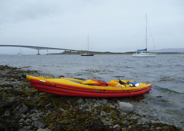
Early in the afternoon, after a quick snack, I launched in Otter Pond by the Skye bridge. A fresh easterly was blowing out of the Loch against the flowing tide, raising the inevitable chop. I crossed the channel towards Kyle, then let myself be blown under the Skye bridge, leaving Eilean Ban to port. I paddled to Erbusaig Bay through the relatively sheltered Black Islands but decided not to proceed directly to Uags under the current crosswinds. Instead, I hugged the coast upwind towards An Dubh Aird from which the crossing would be much shorter.
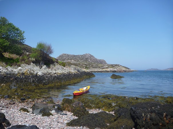
After vain attempts to take a picture of the two little otters which turned around me, I left the lee of An Dubh Aird and rushed towards the south coast of the Applecross peninsula. Two-thirds of the distance into the crossing I bore away and took a direct course to Uags, pushed at speed down the wind blowing along the axis of Loch Carron. Sadly I couldn’t surf the best waves though because the stern was too heavy with the beer. I landed around 6pm in Uags, and moved into the empty bothy.
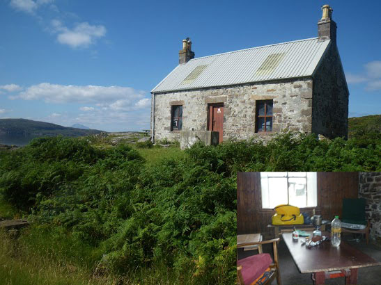
Once installed, I hung my tent and sleeping bag to dry, then I rewarded myself this interesting first step with a hot tea and a thick slice of chocolate cake. Outside rain was still pounding.
Day 2 – Uags to Red Point
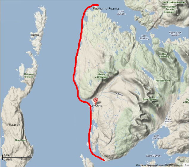
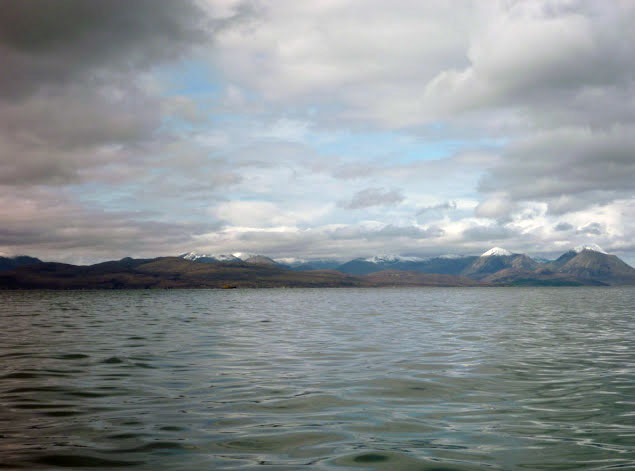
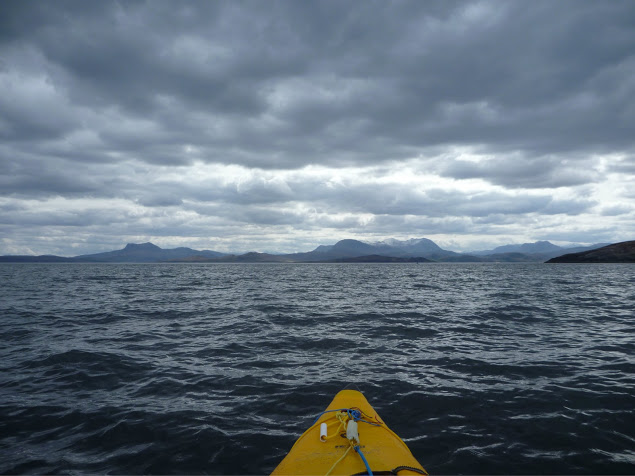
I woke up at dawn feeling numb as my old foam sleeping pad had been of little comfort on the floorboards. The temperature was 5°C; so much for this jet stream. I went out to stretch my body and surprised a little doe grazing in the meadow below the ruined Uags hamlet. It scampered away before I could fetch my camera (this is a double entrendre called ‘lacking reflex’). But – it had stopped raining, the air was clear and visibility was excellent. The snow-capped peaks of the Cuillins stood out beautifully against the sky (below left) but the chill air from the northeast soon sent me back inside.
Once on the way from Uags an unexpected SE tailwind pushed me gently toward Sgeir Shalash but the breeze then turned NE, as expected. In the protected lee of the shore I paddled on north without difficulty, up to Camusteel, but when I reached the mouth of Applecross Bay, I had to fight against the wind. It funneled unhindered along the valley, whipping up the waters and raising an uncomfortable chop, until I reached some shelter in the lee of Rubha na Guailne.
From there the long way north to Loch Torridon seemed a never-ending trudge. The wind had picked up to the point of pushing me hard offshore whenever I got 50 meters from the shore. I kept hugging the coast, despite the uncomfortable chop and the occasional breakers, because the wind was shifting SE, thus pushing me northward. When I eventually passed Rubha na Fearna I found myself facing the wind blowing right out of the Loch.
Loch Torridon greeted me with one of its customary gusts of which I’d had the humiliating experience the year before. I took shelter as soon as I could in a tiny cove hidden behind a natural breakwater. I badly needed a feed.
After a snack and some rest, I pushed off to cross the Loch. I paddled a mile inland to gain an upwind margin of safety then I headed north. Wedged into the seat, with my legs holding tight on the thigh straps and squeezing the footrest, I blithely crossed the choppy zone, kept an eye on the most threatening peaking waves and checked off some landmarks in transit which I used to control my leeward drift with the other eye while admiring the spectacular scenery of the mountains towering over Loch Torridon (yes, all at once).
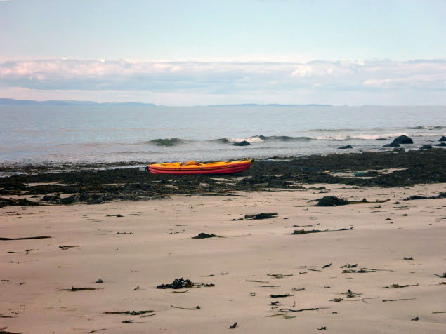
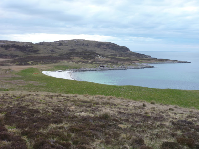
I returned to quiet water in the lee of the north shore, laid the paddle across the boat and started bailing. My open decked Incept kayak had ridden well on the waves but had shipped a fair share of water which was now swashing in the bilge. I pulled ashore in the early evening on a beautiful beach near Red Point.
The ebbing tide had just retreated beyond the tombolo that connects Eilean Tioram islet to the mainland, thus forming a placid lagoon. Some cows and sheep were grazing in the dunes undulating behind the beach. I pitched my tent in a hollow, barely sheltered from the chill NE breeze and crashed out.
Day 3 – Red Point to Slaggan Bay
The night had been cold but the clear morning sky made me hope for a warmer day. When I shoved off I didn’t know that I was about to enjoy one of the most beautiful days of my paddling life.
Passing Red Point I noticed with satisfaction there was almost no swell. For once I wouldn’t be shaken by the rebounding waves and could explore the nooks and crannies of this craggy coast.
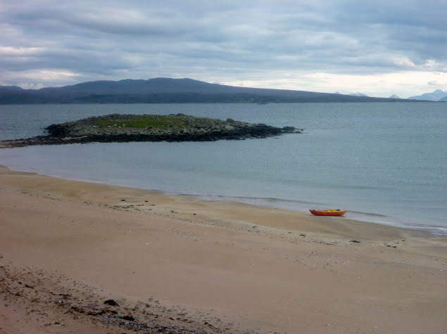
The sky became overcast and the NE wind picked up as I approached Loch Gairloch. The temperature dropped rapidly and I paddled more vigorously towards Carn Deag in an attempt to stay warm. I made a brief stop on the beach at Big Sand (left) but the chill breeze urged me on. I passed downwind along Longa Island with the hope of discovering a sheltered cove for lunch but found none.
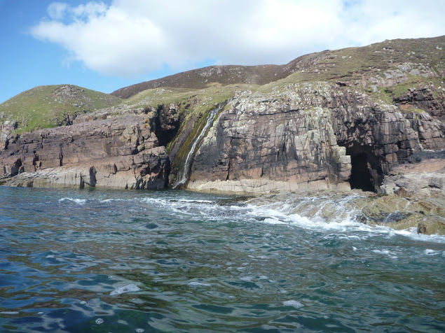
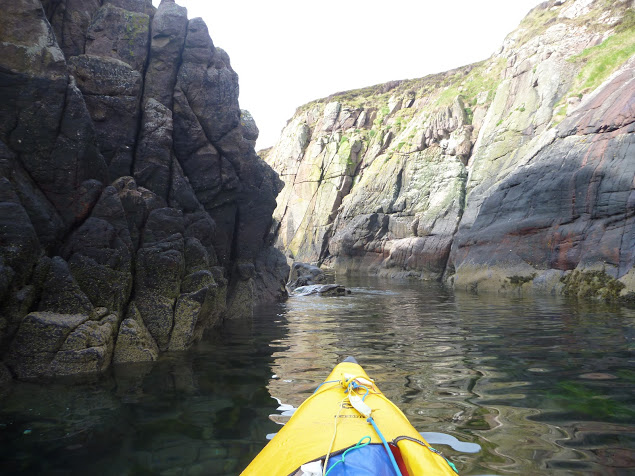
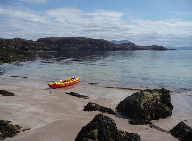
I then went on across Caol Beag, passed Rubha Ban and kept paddling north with my stomach gurgling. The beauty of the coast was worth the inconvenience of being cold, numb and hungry; huge sections of sandstone cliffs that had fallen in the sea provided an extraordinary maze of narrow passages that I enjoyed threading through. Erosion had also cut multiple geos and caves also worth exploring (I didn’t know what a geo was before reading the SSKT guidebook). I eventually reached Seana Chamas beach, largely uncovered by the outgoing tide and where I landed and dragged my kayak a few yards on a carpet of seaweed.
The sea was empty except for birds and a view that stretched westward to the Outer Hebrides. The Shiant Islands were clearly visible, standing out like a motionless line of battleships. I finished my lunch just as the tide returned up to my boat. The sky began clearing as I left and when I got past Melvaig all around me glistened under the sun.
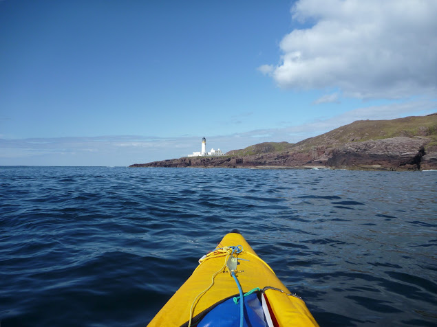
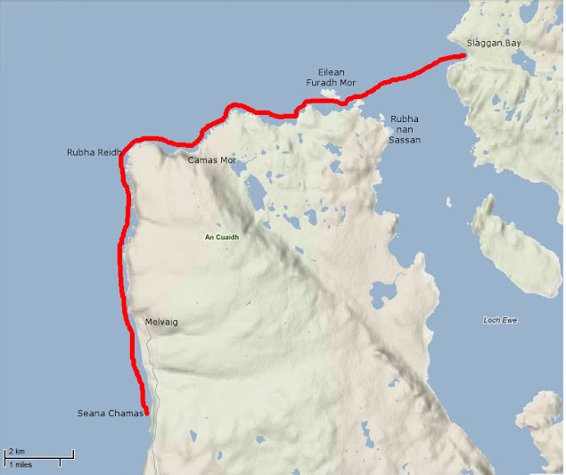
After half a mile of boulders the coast turned to sandstone crumbling cliffs again and I could resume prowling in and out of caves and geos under the bright light of this sunny afternoon. Quite suddenly behind another headland appeared – the dreaded Rubha Reidh and its striking white lighthouse.
I felt the mid-tide current pick up as it dragged me over to the other side of the promontory. The whitecaps of a faster tide rip were visible out to sea but right under the lighthouse the sea was rippling gently against the reddish rocks. One of the most exposed stages on this route passed without event.
The NE wind that had been blowing since I left Kyleakin had dropped too, but there was still some swell from the north, preventing me from sneaking through the rocky labyrinth that stretched between Rubha Reidh and the beautiful beach of Camas Mor.
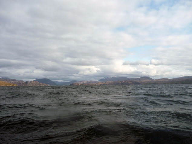
Beyond Rubha Reid to the east the extraordinary snow-capped skyline of the Wester Ross mountain range rose from the horizon (left). Put in a trance by this sight, I carried on on an eastward course and arrived at Caolas an Fhuraidh. I took stock at the mouth of Loch Ewe before an exposed 4km crossing over to Slaggan Bay.
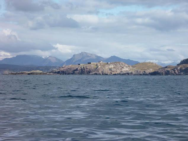
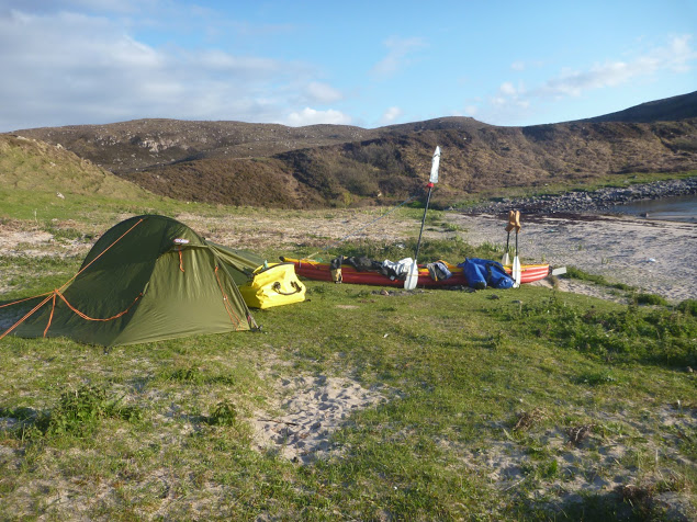
To the SE lay Rubha nan Sasan still with it’s WWII bunkers and gun emplacements. At that time Loch Ewe had been the starting point for many Russia-bound convoys and a haven for Allied shipping. There’s still a NATO base there today. As I paddled to Ploc an t-Slagain I hoped I’d not be rammed by a nuclear submarine entering or leaving Loch Ewe; I’d read reports elsewhere in the Hebrides of these subs rising so fast the resulting wash tipped sea kayaks bow over stern. I reached Slaggan Bay at 7pm finding another perfect landing place, a crescent of fine sand surrounded by empty dunes.
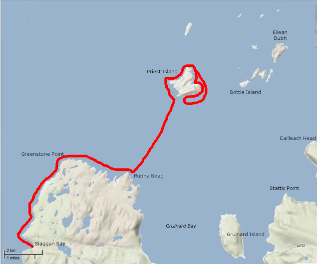
Day 4 – Slaggan Bay to Isle Ristol
Under ideal paddling conditions I hugged the coast towards Greenstone Point, the last critical passage of the SSKT. The Point was flat and bare and proved even less dramatic than Rubha Reidh, although its rocky shoreline was wild and beautiful.
From Greenstone I paddled on to Rubha Beag. In the distance the conspicuous peak of Ben Mor Coigach was towering over the horizon and to the NW lay a scattering of islets; the long-expected Summer Isles.
I headed towards the closest, Priest Island some 5km away. Halfway through the passage, the wind died off and the sea glassed over. The uncanny cries of the guillemots emphasized the eerie atmosphere; I felt like I was entering an unearthly space. From the SE tip of the Priest Island, I carried on around the west side. It was another paddling paradise with endless features to explore in the good company of seabirds and seals.
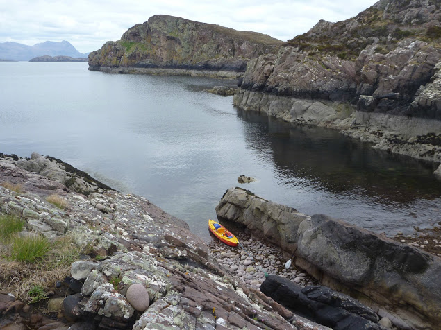
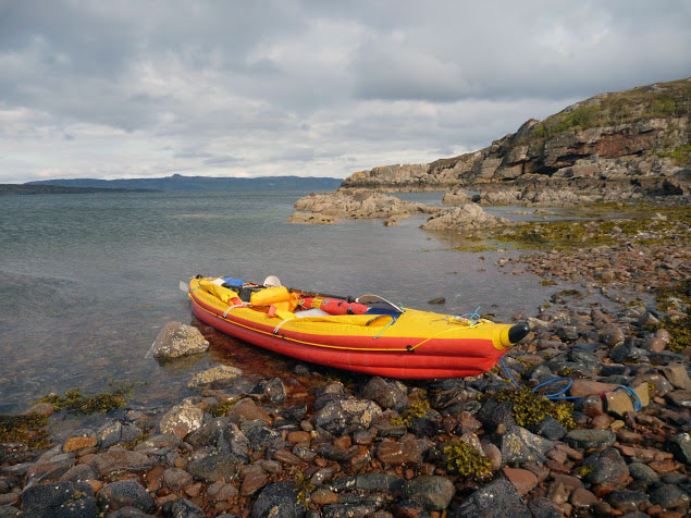
Once I completed this circumnavigation I paddled back to a cove called Acairseid Eilean a Chleirich (it’s quite a challenge to try to explain to other people the places I visited) where I pulled ashore onto a tiny uninviting boulder beach (left).
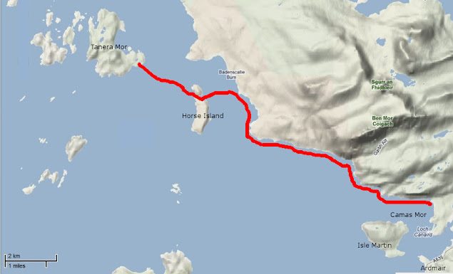
As the afternoon progressed I uneventfully hopped through the convenient chain of islets lying between Priest Island and Tanera Mor, the biggest of the Summer Isles. I had intended to land near Althandu as I needed some of the facilities of the Port a Bhaigh campground, mostly their electrical hookups to charge the batteries, freshwater and even a shower, why not? There was also a pub close by.
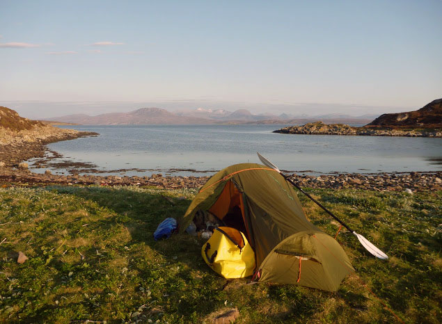
But as I paddled through Old Dornie harbour I came within sight of the campground and within earshot too. The place looked packed and was definitely too noisy. After four days of solitude with no other sounds than the sea and the birds, I couldn’t stand it. So much for the camera, shower and a beer. I swung my boat south towards the lovely nearby beach of Traigh an t-Sean Bhaile on Ristol. I pitched my tent on thick grass which promised a comfortable night and the chilly cold kept any irksome midges from hatching.
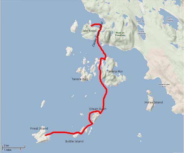
Day 5 – Exploring the Summer Isles
I devoted this day to exploring the archipelago as all these islands offer the type of craggy shore most sea paddlers are looking for. The sea conditions were again at their best for squeezing through narrow channels between rocks, under arches or into caves with almost no swell and light winds. I proceeded anti-clockwise around Ristol, paddling along its west coast then circumnavigated Eilean Glas Mullagrach and Glas Leach Mor.
Shags had built their nests in the crevices of the cliffs overlooking the sea. They were not easy to spot as their colour merged with the cliff but their unmistakable angry squawks betrayed their presence above me whenever I got too close. From Glas Leach Mor (the ‘large green stone’ a good description actually) I crossed to Tanera Beag. Here I gave a wide berth to a skerry occupied by a large group of singing seals that I didn’t want to disturb. The haunting sound suited the scenery perfectly.
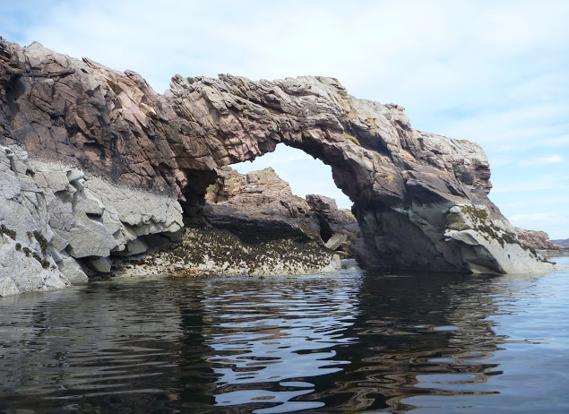
Tanera Beag is considered the most beautiful of the Summer Isles by the experts. Close to its SW corner is a cave deep enough for a tourist boat to get in and with a very high ceiling after which it’s called Cathedral Cave. Its SE corner is adorned with an elegant arch, which is another place of pilgrimage by all paddlers visiting the isles.
After completing the circumnavigation of Tanera Beag I pulled ashore for an overdue snack and a nap in a pretty little cove where the outgoing tide had left a broad sandy beach. Between Tanera Beag and Mor Eilean Fada I entered a kind of shallow lagoon of clear water. The tide was low and I saw my kayak’s shadow skip along the sandy bottom.
Later I landed in the Anchorage on Tanera Mor, a sheltered bay that opens to the east and filled with salmon pens. There is a floating dock for the tourist boat but the tea shop/post office where I’d intended to indulge in a brew and some piece of cake was closed. Tanera Mor (currently for sale) enjoys an offshore status which allows this tiny post office to issue its own stamps but no brew, no cake and no stamps for me today.
I hopped back in the boat and crossed the Anchorage diagonally and skirted Rubha Dubh, the east corner of the island. Here I entered a narrow cove choked with seaweed and backed with a pebble and boulder beach. High spring tides and gales had filled the depression beyond the beach thus forming a lovely pond, An Lochanach.
I pulled ashore soon after two other kayakers. The guy didn’t look very happy to see me and curtly turned down my offer to help them to carry their heavily loaded sea kayaks. So I minded my own business, as I had just been advised to do. His wife came and offered remorsefully to give a hand, but I declined politely.
It had been a hot afternoon and I’d paddled without cag and without a cap for the first time in five days. But cold came back after 7pm and the Franco-Welsh relationships in the cove did not improve. Although our respective pitches were located 300 meters apart, each on one side of the beach, no invitation to share dinner was exchanged. It nice to be alone of course, but I like chatting with other paddlers too. Another time perhaps.
Day 6 – Tanera Mor to Ullapool
On a beautiful sunny morning I headed SE towards Loch Broom and Ullapool. Sunny but cold, chilly indeed, so chilly that I had my breakfast in my sleeping bag.
In the meantime, the wind had shifted SE so I slogged against it all the way to Horse Island. I paddled through the tidal gap which divides this island from its northern tip, Meall nan Gabhar. Once through I pulled ashore and found a very convenient pitching spot.
I regretted not having carried on to this place yesterday, instead of staying next to unsympathetic paddlers. So seemed to say the half-dozen seals romping about behind me. The sky was promising some fair weather that had been a long time coming. As the breeze didn’t abate I took shelter in the lee of Acheninver. But as soon as I got past Rubha Dubh Ard I fought the headwind again until I reached the base of Ben Mor Coigach.
Then I paddled below the sheer slope of the mountain until I got to what looked like the white sands of Camas Mor beach. Actually, it’s a pebble beach facing Isle Martin and the guidebook said amethysts can be found here, but I didn’t find any. By 2 o’clock clouds covered the sky and some chill air forced me back into my cold-weather gear.
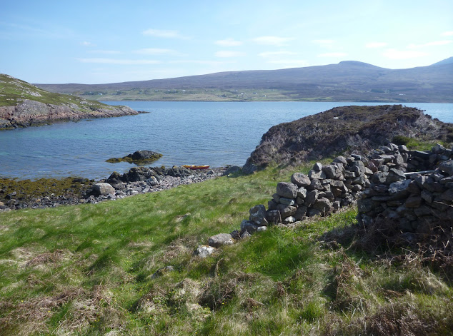
I shoved off shortly after lunch and enjoyed passing the last natural monuments of the Trail. I rounded Rubha Cadail, addressed the last salute to Ben Mor Coigach and entered Loch Broom. The wind unexpectedly veered NW and pushed me gently towards Ullapool.
Once ashore I pitched my tent under the stares of some motorcyclists wondering where the hell I’d come from. A leather-clad fellow told me the owner was already gone and would return early next morning to collect the fee. Meanwhile, I washed the Incept to remove the grit scattered in the bilge, wiped it dry, deflated it, rolled it, and pushed it into my huge 160-l Ortlieb Kanurucksack. The K40 doesn’t fold as compactly as my good old hypalon H2 but I was relieved it crammed into the bag.
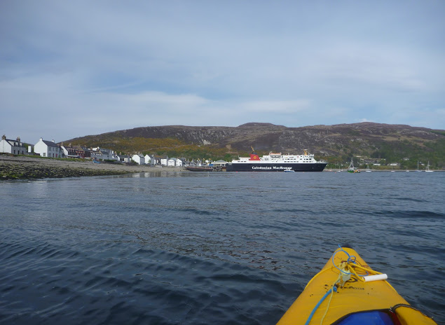
I enjoyed dinner at the water’s edge overlooking at the now placid waters of Loch Broom, glowing in the satisfaction of my achievement. It has taken three years and two different boats, but I’d completed the SSKT in an inflatable sea kayak along with one of Europe’s most striking shorelines. Celebrations continued at the Ferry Boat Inn where I e-mailed friends and family, sipping some good beer, the sound of music replacing the soothing sound of the sea lapping the shore.
Ullapool to Kyleakin
The weather was set to improve in the following days and I wondered whether to paddle north and round the Point of Stoer, take the ferry to Stornoway for a glimpse of the Outer Hebrides, or complete the exploration of Raasay and Rona that I’d started the year before. The first two options required maps that I was not sure to find in Ullapool. and I was also missing sailing directions.
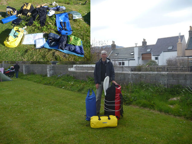
So I packed all my gear in my three-bag travelling arrangement: boat and paddling gear in the 160l Kanurucksack, camping gear and clothes in the 59l XPlorer bag, food, cooking gear, books, maps, tools and all the rest in the 49l Rackpack.
The result was portable but heavy and I had a half mile walk to the bus station by the ferry terminal. Luckily the owner came by for the fee and gave me a lift. Soon we were en route to Inverness by bus; an alternative would have been leaving the bus at Garve railway station, halfway to Inverness and hopping on a train to Kyle of Lochalsh.
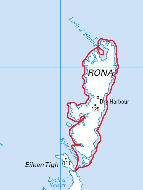
Eventually, I decided to park up in Kyleakin on Skye and undertook a very enjoyable three-day tour around Raasay and Rona. The year before I’d experienced the charms of these islands despite the unsettled weather – this time conditions were ideal.
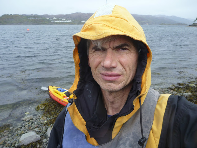
Back at the pier three days later, I was giving the Incept a wash on the slipway when a Land Rover towing a trailer full of sea kayaks turned in. A party of men got out of the truck, unloaded the kayaks and started putting paddling gear on. As they carried the boat to water they came over to say hello and asked about my boat and my trip. They were attending a kayak class beginning this very day. Their first-day program was a shakedown paddle in sheltered waters before a guided multi-day run to Sandaig. The guide joined the conversation and yet again I endured the usual hardsheller’s drivel about IKs. Ten minutes later I watched the student awkwardly clambering in their kayaks; for some of the clumsier it took quite a while. I told them they were lucky modern kayaks had such larger cockpit coamings – but not as big as mine!
By the time I got to my car the temperature inside was like an oven, despite the screen I’d fixed over the windshield. My chocolate bars had melted. In northwest Scotland? Whatever next.